brooke hitching edward the phantom atlas the greatest myths lies and blunders on maps
Brooke-Hitching Edward The Phantom Atlas. The Greatest Myths, Lies and Blunders on Maps
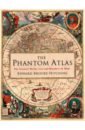
The Phantom Atlas is an atlas of the world not as it ever existed, but as it was thought to be. These marvellous and mysterious phantoms - non-existent islands, invented mountain ranges, mythical civilisations and other fictitious geography - were all at various times presented as facts on maps and atlases. This book is a collection of striking antique maps that display the most erroneous cartography, with each illustration accompanied by the story behind it. Exploration, map-making and mythology are all brought together to create a colourful tapestry of monsters, heroes and volcanoes; swindlers, mirages and murderers. Sometimes the stories are almost impossible to believe, and remarkably, some of the errors were still on display in maps published in the 21st century. Throughout much of the 19th century more than 40 different mapmakers included the Mountains of Kong, a huge range of peaks stretching across the entire continent of Africa, in their maps - but it was only in 1889 when Louis Gustave Binger revealed the whole thing to be a fake. For centuries, explorers who headed to Patagonia returned with tales of the giants they had met who lived there, some nine feet tall. Then there was Gregor MacGregor, a Scottish explorer who returned to London to sell shares in a land he had discovered in South America. He had been appointed the Cazique of Poyais, and bestowed with many honours by the local king of this unspoiled paradise. Now he was offering others the chance to join him and make their fortune there, too - once they had paid him a bargain fee for their passage... The Phantom Atlas is a beautifully produced volume, packed with stunning maps and drawingsof places and people that never existed. The remarkable stories behind them all are brilliantly told by Edward Brooke-Hitching in a book that will appeal to cartophiles everywhere.
7049 Руб.
Brooke-Hitching E. The Phantom Atlas. The Greatest Myths, Lies and Blunders on Maps
A STUNNINGLY ILLUSTRATED BOOK REVEALING THE GREATEST MYTHS, LIES AND BLUNDERS ON MAPS Highly recommended - Andrew Marr A spectacular, enjoyable and eye-opening read - Jonathan Ross The Phantom Atlas is an atlas of the world not as it ever existed, but as it was thought to be. These marvellous and mysterious phantoms - non-existent islands, invented mountain ranges, mythical civilisations and other fictitious geography - were all at various times presented as facts on maps and atlases. This book is a collection of striking antique maps that display the most erroneous cartography, with each illustration accompanied by the story behind it. Exploration, map-making and mythology are all brought together to create a colourful tapestry of monsters, heroes and volcanoes; swindlers, mirages and murderers. Sometimes the stories are almost impossible to believe, and remarkably, some of the errors were still on display in maps published in the 21st century. Throughout much of the 19th century more than 40 different mapmakers included the Mountains of Kong, a huge range of peaks stretching across the entire continent of Africa, in their maps - but it was only in 1889 when Louis Gustave Binger revealed the whole thing to be a fake. For centuries, explorers who headed to Patagonia returned with tales of the giants they had met who lived there, some nine feet tall. Then there was Gregor MacGregor, a Scottish explorer who returned to London to sell shares in a land he had discovered in South America. He had been appointed the Cazique of Poyais, and bestowed with many honours by the local king of this unspoiled paradise. Now he was offering others the chance to join him and make their fortune there, too - once they had paid him a bargain fee for their passage... The Phantom Atlas is a beautifully produced volume, packed with stunning maps and drawingsof places and people that never existed. The remarkable stories behind them all are brilliantly told by Edward Brooke-Hitching in a book that will appeal to cartophiles everywhere.
2805 Руб.
Brooke-Hitching Edward The Sky Atlas. The Greatest Maps, Myths and Discoveries of the Universe
After the enormous international success of The Phantom Atlas and The Golden Atlas, Edward Brooke-Hitching's brilliant book unveils some of the most beautiful maps and charts ever created during mankind's quest to map the skies above us. This richly illustrated treasury showcases the finest examples of celestial cartography - a glorious genre of map-making often overlooked by modern map books - as well as medieval manuscripts, masterpiece paintings, ancient star catalogues, antique instruments and other appealing curiosities. This is the sky as it has never been presented before: the realm of stars and planets, but also of gods, devils, weather wizards, flying sailors, medieval aliens, mythological animals and rampaging spirits. The reader is taken on a tour of star-obsessed cultures around the world, learning about Tibetan sky burials, star-covered Inuit dancing coats, Mongolian astral prophets and Sir William Herschel's 1781 discovery of Uranus, the first planet to be found since antiquity. Even stranger are the forgotten stories from European history, like the English belief of the Middle Ages in ships that sailed a sea above the clouds, 16th-century German UFO sightings and the Edwardian aristocrat who mistakenly mapped alien-made canals on the surface of Mars. As the intricacies of our universe are today being revealed with unprecedented clarity, there has never been a better time for a highly readable book as beautiful as the night sky to contextualise the scale of these achievements for the general reader.
6317 Руб.
Brotton Jerry Great Maps. The World's Masterpieces Explored and Explained
A superbly illustrated guide to 64 maps from all around the world! From examples of medieval Mappa Mundi and the first atlas to Google Earth and maps of the moon, this captivating maps book is a must-have for all history and geography enthusiasts and explorers! Embark on a visual tour of the world's finest maps! This fascinating world atlas book: - Analyses each map visually, with the help of pull-outs and graphic close-up details - Traces the history of maps chronologically, providing a fascinating overview of cartography through the ages - Tells the story behind each map - why it was created, who it was for, and how it was achieved - Profiles key cartographers, explorers, and artists - Draws together navigation, propaganda, power, art, and politics through the world's greatest maps Maps are much more than just geographical data. They are an accurate reflection of the culture and context of different time frames in history. This remarkable geography book puts cartography on the map! It tells the stories behind great maps through stunning pull-out details and reveals how they have helped people make sense of the world. Embark on a global adventure of a lifetime with this world map book and see our planet like never before! On this mind-blowing journey, you'll encounter maps that show the way to heaven, depict lands with no sunshine and even the world ocean floor. With incredible secret stories from British historian, Jerry Brotton, and insight into how mapmakers have expressed their world views, Great Maps is a welcome addition to any armchair cartographer's bookshelf.
7165 Руб.
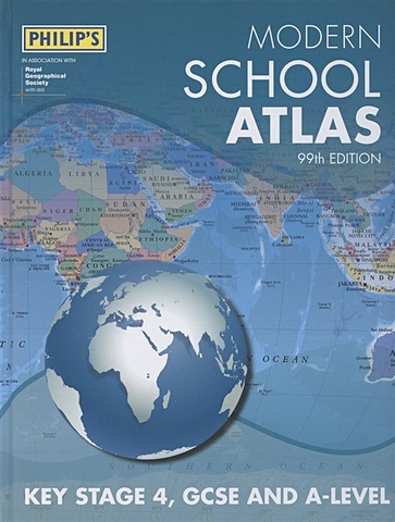
Modern School Atlas 99th Edition
Britain’s best-selling secondary school atlas, now in its 99th Edition. The contents are divided into sections for ease of use, with each page colour-coded for rapid reference. A special Remote Sensing section covers such topics as satellite imagery and GIS. The next section covers the United Kingdom and Ireland in 30 pages. Accompanying the physical maps are thematic maps on numerous key social and economic themes. The middle section is made up of 74 pages of World topographical maps, incorporating continental thematic maps on topics such as climate, population and economics, followed by 30 pages of World thematic maps. Completing the atlas is a section of World social and economic statistics, accompanied by the index to the topographical maps in the atlas, showing letter-figure grid references as well as latitude and longitude coordinates.
1614 Руб.

Blaeu Joan, Van Der Kroght Peter Belgica Regia & Belgica Foederata
This work contains maps of Holland and Belgium from Joan Blaeu's exquisite world atlas of 1665 "The Atlas Maior", the cartographical masterpiece of the Baroque period, was brought out between 1662 and 1665 by the Amsterdam publisher Joan Blaeu, one of Holland's leading cartographers. Originally appearing in Latin, the atlas comprised 594 maps in 11 volumes, which depicted the whole of the world as known to early modern Europe. It was the largest and most expensive book published during the 17th century. For more than 100 years, it remained the definitive atlas of the world, and today is among the most sought-after and valuable antiquarian rarities. This reprinted edition in six volumes is based on the hand-colored, gold-heightened copy in the "Osterreichische Nationalbibliothek" in Vienna, thus ensuring the best possible detail and quality. Alongside Joan Blaeu's original commentaries on the individual maps, a new text by Peter van der Krogt explains the historical and cultural associations and introduces the reader to the fascinating world of early modern cartography. This volume includes all 63 maps of Belgium and The Netherlands and the text is in Dutch, French, and English.
2892 Руб.
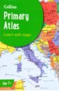
Collins Primary Atlas
The must-have atlas for children aged 7-11 Collins Primary Atlas is a great introduction to mapping of the UK, Europe and all major regions of the world. It supports the Key Stage 2 curriculum and is suitable for children aged 7-11 years. This new, fully up-to-date edition includes information on map reading skills, the meaning of scale and measuring distances, and is ideal for classroom use or home learning. Reference maps: - Informative, politically coloured and easy-to-read - National capitals and major cities are clearly labelled - Maps are supported with national flags and basic national statistics Continental maps: - Linked to regional mapping - Supported by a selection of aerial and terrestrial photographs - Relief maps show layer colouring and highlight major physical features This atlas is also available in a Kindle format. The next atlas in the series is the Collins School Atlas, suitable for ages 11+ and KS3.
2304 Руб.
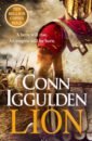
Iggulden Conn Lion
Ancient Greece, 5th century BC The age of myths and legends has given way to the world of men. In the front rank stands Pericles, Lion of Athens. Behind Pericles lies the greatest city of the ancient world. Before him, on land and at sea, stands the merciless Persian army. Both sides are spoiling for war. Though still a young man, Pericles knows one thing: to fight a war you must first win the peace. It's time for a hero to rise. For his enemies to tremble. And for Athens, a city of wisdom and warriors, to shine with glory . . .
4846 Руб.
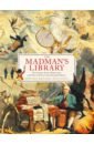
Brooke-Hitching Edward The Madman's Library. The Greatest Curiosities of Literature
From the author of the critically acclaimed and globally successful The Phantom Atlas, The Golden Atlas and The Sky Atlas comes a stunning new work. The Madman's Library is a unique, beautifully illustrated journey through the entire history of literature, delving into its darkest territories to hunt down the very strangest books ever written, and uncover the fascinating stories behind their creation. This is a madman's library of eccentric and extraordinary volumes from around the world, many of which have been completely forgotten. Books written in blood and books that kill, books of the insane and books that hoaxed the globe, books invisible to the naked eye and books so long they could destroy the Universe, books worn into battle, books of code and cypher whose secrets remain undiscovered... and a few others that are just plain weird. From the 605-page Qur'an written in the blood of Saddam Hussein, through the gorgeously decorated 15th-century lawsuit filed by the Devil against Jesus, to the lost art of binding books with human skin, every strand of strangeness imaginable (and many inconceivable) has been unearthed and bound together for a unique and richly illustrated collection ideal for every book-lover.
5364 Руб.
Parker Philip The A-Z History of London
Beautifully presented, a perfect gift for history lovers. For the last century A-Z maps have been the trusted and reliable source of mapping for Londoners. As the face of London has changed so have the maps. History of Britain in Maps author, Philip Parker, outlines these changes. Drawing on maps and photographs from the A to Z archives, Philip Parker reveals how the city has changed over the last one hundred years. Did you know that Phyllis Pearsall walked 23,000 street in order to create the first street atlas of London? The land to build Heathrow airport on was bought for ?15,000 from the Vicar of Harmondsworth? There used to be S and NE London postcodes? London’s skyline has gone from Big Ben and Tower Bridge to include the Tate Modern and The Shard. Several ill-fated projects appeared on maps, including London Millennium Tower and The Sparkplug, which never quite made it into the city’s skyline A beautifully presented book and perfect gift for any map lover and historian.
4685 Руб.
Modany A. National Geographic Kids: Student World Atlas
The new fifth edition of National Geographics award-winning atlas is more fascinating and fact-filled than ever! Its the definitive atlas for high-school students to explore and is ideal for use in the classroom and at home.From the cartographic experts at National Geographic comes the latest edition of its award-winning student atlas, with everything kids want and need to know about our changing world. Dynamic, user-friendly content includes photos, facts, charts, graphics, and full-colour political, physical, and thematic maps on important topics. Completely updated maps and statistics ensure that kids have all the latest information so they are informed as they learn more about current events and become the next generation of informed global citizens.
875 Руб.
Bryson Bill Shakespeare. The World as a Stage
Bill Bryson’s biography of William Shakespeare unravels the superstitions, academic discoveries and myths surrounding the life of our greatest poet and playwright. Ever since he took the theatre of Elizabethan London by storm over 400 years ago, Shakespeare has remained centre stage. His fame stems not only from his plays – performed everywhere from school halls to the world's most illustrious theatres – but also from his enigmatic persona. His face is familiar to all, yet in reality very little is known about the man behind the masterpieces. Shakespeare’s life, despite the scrutiny of generations of biographers and scholars, is still a thicket of myths and traditions, some preposterous, some conflicting, arranged around the few scant facts known about the Bard – from his birth in Stratford to the bequest of his second best bed to his wife when he died. Taking us on a journey through the streets of Elizabethan and Jacobean England, Bryson examines centuries of stories, half-truths and downright lies surrounding our greatest dramatist. With a steady hand and his trademark wit, he introduces a host of engaging characters, as he celebrates the magic of Shakespeare's language and delights in details of the bard's life, folios, poetry and plays.
1595 Руб.
Collins Junior Atlas
The must-have Back to School Atlas for Year 6 Fully revised and updated, this is an ideal world reference atlas for young primary school geographers aged 8-11 years (Key stage 2). Published in association with the Geographical Association, it enables children to learn about the world today and understand how maps and atlases work. - The atlas is organised into sections covering the UK, Europe, the world and continents with more detailed larger scale maps of countries and regions popular for focus studies. - It includes topics such as climate, population, migration, trade and environmental issues, such as global warming. - Topographical based mapping helps the young geographer understand the processes which take place during the formation of the earth's landscapes. - The reference mapping is designed for maximum clarity and accessibility, and is supported by photographs and data boxes, with detailed map keys and scale information on each map. - Specially selected topic maps give additional information linking to knowledge and understanding of distant places. - Tables of key world country data include an Ecological Footprint figure for each country.
2592 Руб.