tschechische republick superatlas 1 150 000
Tschechische Republick. Superatlas 1:150 000
Touristische Informationen, Ortsregister mit Postleitzahlen, Entfernungen in km, Cityplane. 1:150.000, Europa 1:3,5 Mio.
2340 Руб.

Italien. Superatlas 1:150 000 / 1:400 000
Italien. M 1:150 000 / 1:400 000. Крепление: двойная евроспираль.
1660 Руб.
Croatia. Slovenia. Superatlas 1:150 000
Spiral-bound Superatlas of Croatia and Slovenia at 1:150,000 scale (1.5 km per cm) that depicts elevation with shaded-relief and color tinting. The 97 map pages for Croatia and 72 pages for Slovenia show highways and roads, scenic routes, rail and ferry lines, ports, distances in kilometers, hotels/inns/campgrounds, natural features, parks, and places of interest. Thorough placename index for both countries. Also included are city center plans for Dubrovnik, Karlovac, Osijek, Pula, Rijeka, Sibenik, Slavonski Brod, Split, Trogir, Umag, Zagreb, Varazdin, Zadar, Celje, Kranj, Koper, Murska Sobota, Ljubljana, Maribor. Includes section on Europe at 1:3.5 million scale (35 km per cm). Map legend in Slovak, Slovenian, Italian, Spanish, Dutch, German, English, French and other languages. Крепление: двойная евроспираль.
1850 Руб.
Romania. Superatlas 1:300000
Spiral-bound Superatlas of Romania at 1:300 000. Крепление: двойная евроспираль.
1851 Руб.

Roads & Cities Austria. Europa. SuperAtlas 1:150 000 - 1:350 000
Touristische Informationen, Ortsregister mit Postleitzahlen, Landeshauptstadte Osterreich, Hauptstadte Europa, Stra?enverzeichnis. Laufzeit bis 2013. Getr. Pag. Mit zahlr. farb. Ktn. u. Pln. 30 cm 1450g Osterreich 1:150.000 u. Europa 1 : 3,5 Mio. Spiralbindung , in niederlandischer / flamischer, italienischer, spanischer, deutscher, franzosischer und englischer Sprache. Крепление: двойная евроспираль.
1660 Руб.
Scandinavia. SuperAtlas 1:250 000-1:400 000
Touristische Informationen, Ortsregister mit Postleitzahlen, Cityplane, Stra?enverzeichnis, Campinplatze, Entfernungen in km. Laufzeit bis 2014 16, 471, 64 S. m. zahlr. farb. Ktn. u. Pln. 30 cm 1850g 1:250.000 u. 1:400.000 Spiralbindung , in englischer, franzosischer, niederlandischer / flamischer, deutscher, norwegischer, schwedischer, danischer und finnischer Sprache. Крепление: двойная евроспираль.
2288 Руб.
Hungary Supertouring Road Atlas 1:200 000
Ungarn Supertouring Autoatlas. M 1:200 000. Spiral-bound Superatlas of Hungary at 1:200 000 scale that depicts elevation with shaded-relief and color tinting. The map pagesshow highways and roads, scenic routes, rail and ferry lines, ports, distances in kilometers. Thorough placename index. Крепление: двойная евроспираль.
1244 Руб.
Sweden. Supetouring Road Atlas 1:400 000
Schweden Supertouring Autoatlas. M 1:400 000. Spiral-bound Superatlas of Schweden at 1:400 000 scale that depicts elevation with shaded-relief and color tinting. The map pagesshow highways and roads, scenic routes, rail and ferry lines, ports, distances in kilometers. Thorough placename index. Крепление: двойная евроспираль.
1362 Руб.
Germany. Austria. Switzerland. Superatlas 1:300 000
Touristische Information, Ortsregister mit Postleitzahlen, Cityplane, Strassenverzeichnis. 1135g 1:300.000, Europa 1:3,5 Mio. Spiralbindung. Grossdruck, in franzosischer, italienischer, spanischer, deutscher, englischer und niederlandischer/flamischer Sprache.
1756 Руб.
Norway. Supertouring Road Atlas 1: 400 000
Spiral-bound Superatlas of Norway at 1:400 000 scale that depicts elevation with shaded-relief and color tinting. The map pagesshow highways and roads, scenic routes, rail and ferry lines, ports, distances in kilometers. Thorough placename index. Крепление: двойная евроспираль.
1123 Руб.
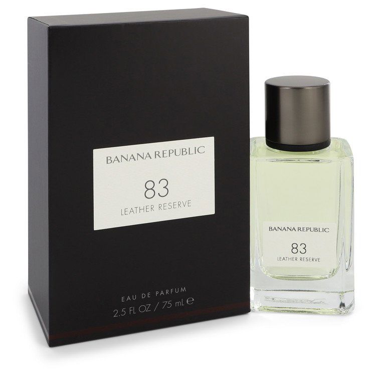
Духи K 83 leather reserve eau de parfum Banana republic, 75 мл
Созданный Винсентом Кучински Banana Republick 83 Leather Reserve — это простой утонченный древесный аромат, дополненный цитрусовыми специями и мягкой замшей. Начало искрится свежими элегантными аккордами бергамота, цедры лимона и ароматного кипариса....
9527 Руб.
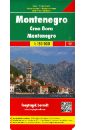
Montenegro/ 1:150 000
Montenegro. Crna Gora. Road + Leisure Map. 1:150 000 - tourist information - suitable for GPS - index with postal codes
593 Руб.
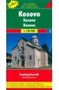
Kosovo 1:150 000
This map appears in the map series world mapping project in travel expertise. Characteristic is the high-quality, clear and modern cartographic representation. Contour lines with elevation Coloured elevation levels Classified road network with distances Places of interest Detailed local index
608 Руб.
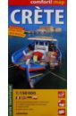
Crete. 1:150 000
laminowana mapa turystyczna 1:150 000 format: 100 x 48 cm, po zlozeniu: 11 x 24 cm Dwustronnie laminowana, wygodna w skladaniu mapa turystyczna Krety bogata tresc turystyczna, m.in.: muzea, zabytki i inne interesujace obiekty (m.in. starozytne miasta, fortece, zamki, grobowce, swiatynie) szlaki turystyczne, kempingi, pola namiotowe parki narodowe, atrakcje przyrodnicze, winnice, gaje oliwne, lasy, zakrzaczenia cieniowanie plastycznie pokazujace uksztaltowanie terenu mapa zgodna z GPS - wspolrzedne geograficzne w ukladzie WGS-84 wszystkie nazwy w alfabecie lacinskim i greckim plany najwazniejszych miast: Chania, Rethymno, Iraklio, Agios Nikolaos, Sitia, Ierapetra
937 Руб.
Plattensee. 1:150 000
This road map foldable into a practical format contains detailed information suitable for motorists and other travelers planning to visit the given country or area. The road map features symbols indicating notable tourist attractions and public transportation.
548 Руб.